-40%
Colorado Placer Gold Mine Creek Mining Claim Silver Panning Sluice Snipe
$ 3300
- Description
- Size Guide
Description
Cottonwood Creek MineDepartment of Land Transfer Info
Equipment
Feedback
Other Claims for Sale
Contact Us
Add To Favorites
VICKSBURG GOLD MINE
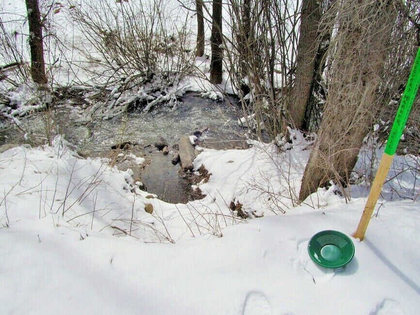
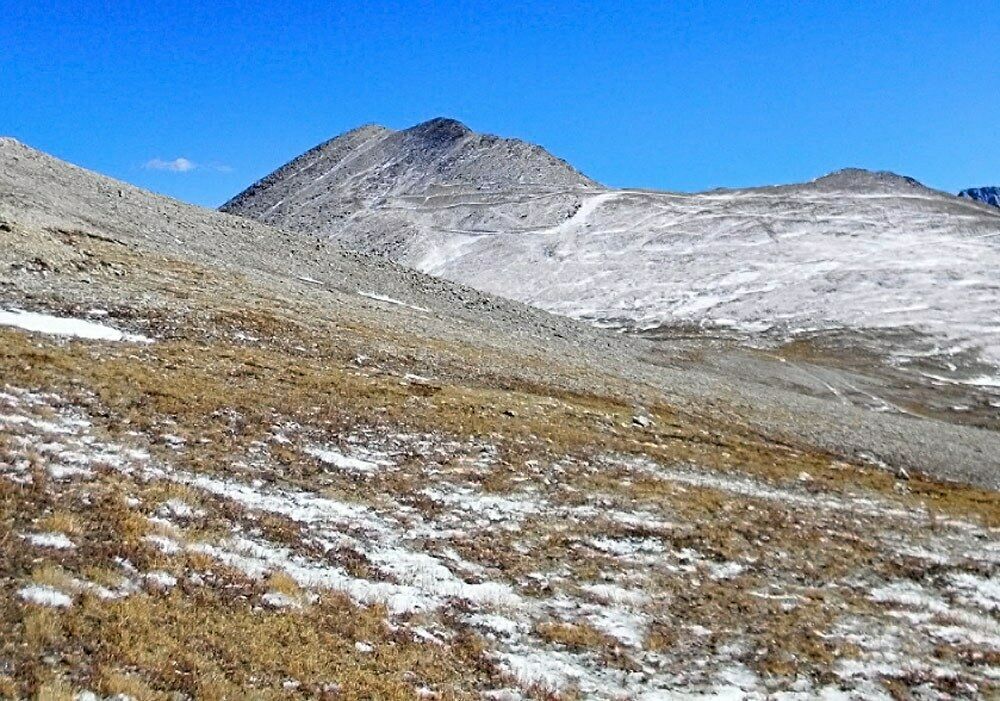
This 20 acre placer claim and spans over 973 feet of prime working water on Cottonwood creek.
The creek runs parallel with county road R, which is a nice well maintained wide dirt road that is relatively private on national forest land. The Cottonwood creek ranges from 10-50 ft. from the road, which results in easy 2WD access.
Cottonwood Creek has parking and camping areas available, but also is only 20 minutes away from the closest town if hotels are preferred.
QUICK FACTS ON THE MINE:
Commodities:
Primary Gold / Secondary Silver
County:
Dolores, CO
Elevation:
7,608 feet / 2,319 meters above sea level
Access:
Cottonwood Creek is located right next to the road, which makes for easy access to reach the claim. US Highway Fs Road 532 is a well maintained paved road and accessible by 2WD. The creek flows about 10-15 feet away from the road, so you have easy access to and from your vehicle.
These placers contain gold which was undoubtedly derived principally from the mineralized areas at the heads of the San Miguel and South Fork. A minor contribution of gold may have been made from the ore deposits of the Mt. Wilson district at the head of Big Bear Creek and perhaps from those near Sawpit. The San Miguel watershed was the source of the placer gold on the Dolores River below the mouth of the San Miguel, for there are no placer deposits on the Dolores for many miles upstream from the junction.
The road cuts through this claim making for easy access
With Camping nearby
The mesas into which the canyon is cut are rolling surfaces of considerable relief; most of them are capped with Dakota sandstone. The valley slopes are either a succession of cliffs and benches or gentle slopes. The valley is narrow and youthful, except in the section from near Naturita to Uravan, which is approaching maturity.
. The creek itself ranges from 6-22 ft. wide, and flows year round at a good rate. The depth of the creek ranges from 8-10 inches for the shallow areas to up to 3-4 ft. deep in the deeper areas. .
Buyer will receive the following with their completed transaction:
Quitclaim deed showing full ownership of the claim. This will be stamped, recorded and verified with the County and the BLM offices.
Welcome packet with all of the rules and regulations as they relate to the State and BLM where the claim is located.
Educational documents to annually renew your mining claim with the BLM.
A CD of all of the documented images of the claim including maps of the site.
Map of claim marked and GPS coordinates.
Multiple maps showing claim location and surrounding areas for access.
The color in the water is very vibrant any way you look
Come to Hike, Camp, Ride and Shoot - or come to pull some shiny rock$ out of the ground;-)
COTTONWOOD CREEK MINING
The principal placers along the San Miguel and Dolores Rivers are in three areas. One extends downstream for 9 miles from Sawpit, one downstream for about 22 miles from Cottonwood Creek, and the third upstream from Roc Creek for about 6 miles. The first area is in San Miguel County; the others are in Montrose County. Placerville is near the center of the first area, and Naturita near the center of the second; Uravan is about 9 miles upstream from the third. The placers range from 7,700 feet elevation near Sawpit to 4,744 feet below Rock Creek. They lie in a usually narrow, steep-walled canyon cut in the mesas between the northwest flank of the San Juan Mountains and the southwest flank of the Uncompaghre Plateau.
The canyon walls are broken by a number of bedrock benches on which the placer gravels have been deposited. They are locally covered with pine and juniper trees and small brush. State and county highways parallel the rivers through most of the placered areas.
COUNTY HISTORY:
Dolores County, in southwestern Colorado, contains deposits of silver, lead, and zinc in the mountainous eastern part, which is a dissected laccolithic dome. The western part of the county is within the Colorado Plateaus. Dolores County has had a total gold production through 1959 of about 104,500 ounces; almost all production has been a byproduct of silver, lead, and zinc deposits of the Rico district. (western mining history)
ACCESS
*Before heading to the claim, you will need to check the road conditions, since some of the roads can be closed different times and days
The area is full of dirt roads, so a good map and a good GPS unit is a must, but we'll show you exactly where it is on the map as well as provide you with the precise latitude and longitude of each corner marker, so finding it will not be a problem for you.
I advise caution whenever driving or hiking on this claim – the entire valley is dotted with abandoned mines – most of them are easy to see from a distance, but some of them are impossible to see until you are right on top of them. I would estimate that only 20% of them are roped or fenced off – the rest are wide open and you should be extremely careful if entering them.
A couple of spare tires or an air compressor and patch kit or at least a couple of cans of tire sealant is strongly recommended for obvious reasons! Also, be sure to bring in whatever water you may need, as there are almost no water sources in the area 10 months out of the year.
Mining claims are a tangible asset just like any other Real property (real estate) and show a lifetime proof of all interests in minerals in the area specified by the above claim. Once you own this claim and the associated mineral rights, you will own them for life as long as you keep up with the annual fees. This claim can be bought, sold, leased or used as collateral, just like any other piece of real estate.
A mining claim can be willed or passed down to future generations as part of a trust or your estate, or you can trade it, lease it out for a period or time (or indefinitely), gift it to a family member or friend and you can also transfer or sell just an interest in it in part or in its entirety just like any other real property using a quitclaim deed which is a recordable conveyance. In other words, you could sell a 25% or a 50% share in it if you wanted in order to bring on a partner in the future - or you could sell the entire claim in whole.
This Buy-It-Now is for full/all interest in this 20 acre placer mining claim (unless the acreage indicated in the above mine description is different). This claim covers the entire site, (unless the claim description above describes different measurements), and includes full rights to all minerals, gems and just about whatever else you may find of value on the property (except oil and gas, which are handled separately). The buyer will receive a notarized quitclaim deed to the full claim and all associated documentation showing full ownership of the claim. We pay ALL fees associated with transferring this claim into your name - legal fees, title transfer fees, document fees, notary costs, recording fees and even shipping fees, so all you will pay is the final price of the auction, not a penny more.
In order to hold on to your claim for life, you will need to pay an annual maintenance fee to the Government (BLM, not us) every year. Currently the maintenance fee is 5 per year per claim that you own, and it is due on September 1st of every year.
NOTE that if you own fewer than 10 claims nationwide, we can assist you in filing the paperwork to waive the maintenance fee every year. That means you will only pay per year for your maintenance fee instead of 5. We guarantee that all past fees have been paid in full and there are no outstanding debts or amounts owed on the claim prior to the transfer of ownership into your name.
The federal government retains ownership of the land - so this means that you will not have any annual real estate taxes due on your mining claim, and you will not have to maintain liability insurance in case someone gets injured on your claim due to no fault of your own.
How do Transfers of Ownership in Mining Claims work if I decide to sell my claim in the future?
First, we handle all the paperwork and costs associated with transferring this claim into your name. But if you decide to sell this claim at some point in the future, interest in a properly recorded mining claim or site may be transferred (i.e sold) in part or its entirety. A quitclaim deed or recordable conveyance document is required and if you do sell your claim someday and the transfer documents should be filed within 60 days after the transfer.
We can and will help you with the paperwork for no cost should you need a hand selling your claim in the future if you pay all of the County, State and Federal fees (usually less than to ).
But again - with regard to transferring this claim initially into your name, we take care of all the paperwork at our expense. You do not have to worry about anything. we handle the BLM transfer documentation and the county recording.
Can you build / camp on your claim?
Without an approved plan of operations, you have the same rights and restrictions as the public. If the area is open to camping to the public, then it is permissible. However, you need to check with the BLM Field Office or the local District Ranger for areas open to camping. Under Federal law in order to occupy the public lands under the mining laws for more than 14 calendar days in any 90 day period, a claimant must be involved in certain activities that (a) are reasonably incident; (b) constitute substantially regular work; (c) are reasonably calculated to lead to the extraction and beneficiation of minerals; (d) involve observable on-the-ground activity that can be verified; and (e) use appropriate equipment that is presently operable, subject to the need for reasonable assembly, maintenance, repair or fabrication of replacement parts. All five of these requirements must be met for occupancy to be permissible.
Although it is possible to build a permanent structure on a mining claim, it is extremely expensive and you will have to jump through way too many hoops to consider it easy to do. It would have to be in support of a commercial, year-round mining operation for starters, and you would need to post a large reclamation bond to insure that if you ever abandoned your claim, the bond would pay for the removal of the structure and the reclamation or the area. So in short, it is technically possible to build on your mining claim, but just be aware that it is very difficult and expensive to do - however, camping is almost always involved unless your claim is in a wilderness area, which is not very common at all.
Proud Member of:
In addition to handling all of the paperwork to transfer this claim into your name, as well as paying all of the fees so you do not have any costs, we also pay all of the costs associated with mailing the paperwork to you as well as to the County and Federal Government for recording and sending you back certified copies.
We will ship you a folder with all paperwork, claim coordinates, maps and information on your claim, including a CD-Rom with all of the pictures of your claim upon your payment in full clearing. We ship everything to you the same business day (if payment is received by 1:00 PM Pacific Standard Time) - and we will always provide you with the tracking information so you are always informed.
You initial claim packet that we mail has an unrecorded deed so that you can show ownership immediately after payment and be able to visit your claim. A second original deed goes to the County for recording the same day, and a third original deed goes to the BLM for certification as well. Both of those originals will be returned to you so you will wind up with several original deeds - but the County and BLM deeds can take 3 to 6 weeks to be returned to you, which is why we send you the initial original on day one.
Your payment of this eBay Buy It Now item in full gives you 100% ownership of this entire claim, with no other fees and/or other costs for the transfer of ownership required. This is NOT for the down payment, this is NOT a partnership arrangement where someone else will own part of the claim with you, and there are NO other fees or costs for the transfer of this claim in your name.
